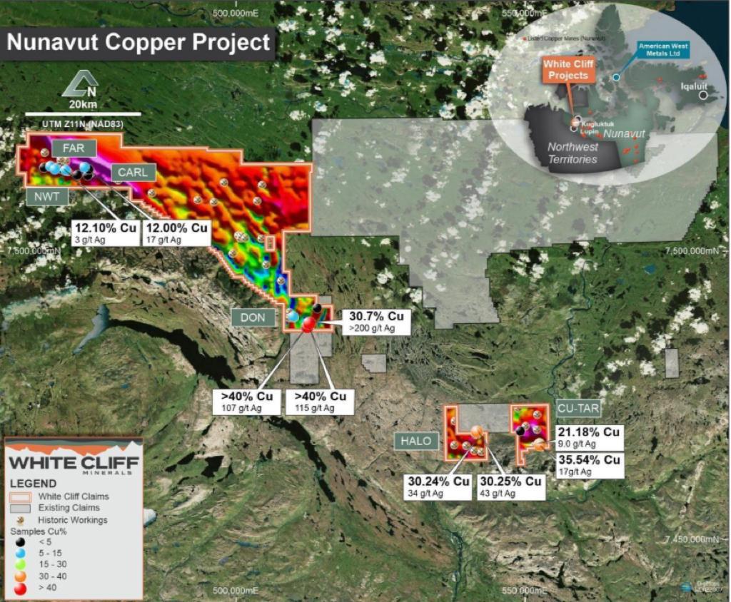

The Coppermine River Project covers 805km2 of flood basalts, including multiple, highly prospective mineral showings/outcrops. Most of these copper occurrences are structurally controlled along steeply dipping fault fissures and fault-breccia zones in the basalts. Mineralisation occurs mainly as massive bornite-chalcocite occurrences with lesser chalcopyrite and associated calcite, hematite, native copper and chlorite.
The geology of the Coppermine District is characterised by an easterly-trending copper-bearing belt of Meso-Proterozoic continental flood basalts and associated marine sedimentary rocks of Neo-Proterozoic age. This belt extends 80 kilometres south from Kugluktuk, on the Coronation Gulf, and 174 kilometres west to 64 kilometres east of Coppermine River. The district is best known for the ‘Coppermine River Group’ basalts which feature extremely high-grade copper showings of >45% Cu within the volcanic pile. The Company will initially base its logistical hub in Kugluktuk, a town of approximately 1,500 people, around 30km to the north of the project area. Kugluktuk is accessible by both plane and ship.
Proposed initial exploration and study activities
The Company proposes to undertake the following exploration and study activities this will be based on successful exploration methodologies adopted for similar sedimentary and volcanic copper deposits both locally and at similar provinces:
- Field crews will be mobilised in due course for orientation / reconnaissance and planning for future work.
- Acquisition of all high resolution satellite hosted products, ariel photography and multispectral and electromagnetic data.
- Assessment of modern airborne geophysical techniques for targeting, particularly electromagnetic surveys, such as MobileMT
- Diamond drilling to test the extensional potential of high grade structurally controlled and stratiform copper mineralisation.